Tuesday, April 30, 2013

Change Is Gonna' Come...

You know, the more I think about it, the more I'm convinced that the one thing in our lives which remains constant and unwavering is change.
 
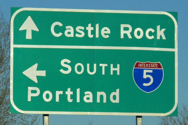
In November, I left San Diego for Portland, Oregon. It was a move which, at the time, I was pretty convinced made a lot of sense. Whether that's the case or not will, I suppose, be borne out by the success or failure of my upcoming move, which will take me about as far out of Portland as one can get: St. Augustine, Florida.
 
Don't get me wrong; Portland certainly has a number of good points.
 
First, from a photographer's perspective, it's going to be hard to beat the Pacific Northwest for natural beauty. From Mount Hood to Mount St. Helens, from Cannon Beach to Grant's Pass and Hellgate Canyon, it's a five star feast for the eyes. Some of my favorite photos I've ever taken have been shot since I crossed the California/Oregon border in November.
 
But it's time to go.
 
I started working in the music industry (in a very broad sense) back in 1997, when I started working at Moze Guitars in San Diego. I went from working for that small shop on College Avenue to working for one of the largest acoustic guitar companies on the planet. I left that job, though, in February of 2012.
 
After taking much of 2012 off, I was offered the position I have at the moment, at a very well respected retailer in Portland. I'll be forever grateful for the opportunity they gave me, especially as I was hired based solely on my reputation; nary a resume' or employment application as far as the eye could see.
 
Initially, I'd planned on being here for at least a year. I figured that would give me a solid basis of time and experience on which to decide to stay or not. Well, a near-death experience on Christmas Day convinced me, for a number of reasons, that I would probably roll through the summer and, in the Fall, pack my bags and head out. A phone call I received from an old friend, however, accelerated what otherwise would've likely been simply a protracted departure.
 
I was offered a position as a photographer in Pennsylvania. It's a temporary gig; seven weeks, but the pay is very good, and my expenses (primarily room and board) are paid for. They're also off-setting some of my travel expenses. It's slowly but surely dawning on me that my camera will, finally, become the breadwinner.
 
What this means in the immediate, though, is that I've got another move in front of me, and it's a big one. In about a month, I'm going to be making the drive from Portland, Oregon to St. Augustine Florida, by way of Pennsylvania. I keep seeing the word "epic" flashing in my mind's eye.

I've driven cross country twice, both times from Charleston, South Carolina to San Diego, California. Each time, the emphasis was on the amount of time spent traveling, and not on what we might've actually been able to see had we taken the time to get off the beaten path (also known as US Interstate 10) for a little while.

I don't want to make that same mistake again.

As it sits right now, I'm going to try to shove off from Portland at zero-dark-thirty on Monday, May 27th. It's Memorial Day, so traffic should be minimal if I leave early enough.

When I drove from San Diego to Portland, I didn't have to put a lot of planning into the actual driving aspect of the trip. I drove from San Diego to my buddy Chris' house in the Bay Area, then on to Grant's Pass, Oregon and then to Portland. It was a distance, but the stops were pretty much known, as it was only a four day trip. This go-round, though, is a bit more protracted. I don't need to be in Pennsylvania until Thursday, June 20th. I'm going to have better than three weeks with which to make this drive, and I intend to exploit the Hell out of that timetable.

The trip will include stops at places I never thought I would see (Crazy Horse and Mt. Rushmore, for example), as well as stops along to the way to visit some old friends and family in places like Chattanooga, Tennessee, Louisville, Kentucky and Albrightsville, Pennsylvania. It's going to include stops in places for which the decision to stop there was no more involved than seeing that it was along the way. My itinerary has places like Florence, Montana and Sheridan, Wyoming on it. While it has a stop in Kansas City after leaving Sioux Falls, South Dakota, I may just "To Hell with it" and muscle on through to St. Louis before calling it a day.

What I'm most excited about, though, is that my Canon 5D is going to be riding shotgun. I'm not going to make the mistake of not stopping. I'm not going to make the mistake of not turning back to get a particular shot. I'm looking at this trip, in some respects, as a "bucket list" level endeavor, and I intend to get the most out of it.

I'm hoping to have some wi-fi along the way, and I'm guessing that any lodging will have, at least, that.. I don't plan on staying at the Marriott or the Hyatt. Places like "Uncle Cephus' Wagon Wheel Inn" will appease me nicely. If they've got wi-fi, all the better. If nothing else, I'll take the opportunity to get photos posted to Facebook and Flickr.

I'm also considering doing some sort of publication documenting the trip. I'll probably end up doing either a calendar or a book. Hell, I may just decide to do both. If I do them, they'll be made available for purchase and, seeing as my camera is now my meal ticket, I sure would appreciate some support there! It's going to be just me and Boo, my Inukshuk, finding our way across the country to the east coast, to a new life with new challenges.

So, in short, Portland has been good, but it's time to go. I'm fortunate to know some amazing people here, and I'll never forget them, their friendship or everything they did for the new guy in town who knew no one, and could find nothing.

But, as I look at the calendar, it's quite apparent to me.

It's time to go...

Wednesday, April 24, 2013

Cottage Grove...

It's becoming more and more evident to me just how picturesque the Pacific Northwest can be. Having driven the west coast from the Mexican border to Portland, and from Seattle to Vancouver, BC, I have to say that it's simply one of the most amazing areas along the west coast. And, come to think of it, I should probably just make the drive from Portland to Seattle, just so I can say I've knocked out the entire west coast.

I guess that's a separate issue, though.
 
I'd heard of a small town, just south of Eugene (which is about two hours south of Portland), called Cottage Grove. Cottage Grove is one of those small Americana-ish towns that make take a while to be found on a map, having a population which hovers right around 10,000. But Cottage Grove has a history. It was first settled in 1855, and went through not only a couple of name changes, but also a couple of location changes, until 1899.
 
It's also found its way into the hearts of Hollywood through the years. Scenes from the movie "Stand By Me" were filmed here in 1986, on the railroad tracks along what is now known as the Row River Trail:
 
DVD cover from "Stand By Me"...
 
Buster Keaton's "The General" was filled here in 1926. In 1997, the movie "Ricochet River" (yeah, me neither), starring Kate Hudson, was filmed here. And, perhaps far more famously, who can forget the final, climactic scene from that 1978 cinematic juggernaut of all things right and good with American youth, "Animal House":


What I came for, though, had nothing to do with the movies. I came here for covered bridges. Let's face it, covered bridges are damn near a photographer's wet dre... um, we really like them. They're a tangible link to the past and, let's be honest, they photograph really well. I've shot covered bridges from New Brunswick, Canada to Littleton, New Hampshire, to right here in Oregon, and I've always been happy with the results.

Before getting to any of the bridges, though, I drove along what's known as the Row River Trail. The Row River Trail is biking & hiking trail that runs around Dorena Lake. After I parked the truck, it was just a few steps to the shore of the lake, and some pretty fabulous photo ops:


Lake Dorena in Cottage Grove, Oregon...

Dorena Lake...

Everything's peaceful at 7:00am...

Dorena Lake...

One of the countless trees that's washed up on the shores of Dorena Lake...
 
After hiking around the lake for a little while (and giving the new Vasque's a mild workout), it was time to head back to the truck and go seek out the covered bridges. Cottage Grove has seven covered bridges in all, and I managed to track down four of them. In hindsight, I should've done a little more research, as I later learned that the remaining three were in pretty close proximity. Not all of the bridges are open to vehicular traffic, but you're still able to walk across them.


The first bridge I came up was the Dorena Covered Bridge, which was built in 1949. It's one of the ones opened to vehicular traffic, so I took advantage:
 
The Explorer on the Dorena Covered Bridge, which was built in 1949...
 
Dorena Covered Bridge...

The Dorena Covered Bridge...

 Aside from being the longest of the bridges I would see, the Dorena Covered Bridge was also the widest, and by a fair margin. Being that it was built relatively late (1949), I can imagine that it was to accommodate increased logging traffic, at least until such time as the nearby concrete bridge was constructed.
  
As I drove in search of the next bridge, I was reminded of just how amazing this part of the country is, scenically speaking. It's truly an amazing thing:
  
The view along a portion of Row River Road...
 
The next bridge I found was the Stewart Bridge, which was constructed in 1930. The ol' gal just ain't what she used to be, apparently, so it's permanently closed to vehicular traffic. It's also really, really short:
 
Stewart Bridge, built in 1930...
 
Next up was the Mosby Creek Bridge. This bridge, like Dorena, is open to vehicular traffic. Unlike Dorena, though, it's very narrow, accommodating only one lane of traffic:
 
The Mosby Creek Bridge...

The single-lane Mosby Creek Bridge dates to 1920...
 
One thing that the Pacific Northwest is somewhat known for is its wildlife. Whether it's a bear or an eagle or a deer, there's no telling what you might see next.
 
Seriously, there's just no telling:
 
Wild turkeys near the Row River...
 
After driving to the point where I thought I might actually be a little lost, I saw another bridge off to my left. This was the Currin Bridge, which was originally built in 1883, but required reconstruction by the county in 1925:
 
The Currin Bridge. It's no longer open to vehicular traffic...
In retrospect, I think it would be possible to spend, easily, an entire day meandering around this part of Oregon. Much of what you see are things you didn't even know you were looking for. But it's all here and, if you've got a sunny day and a full tank of gas, there are worse ways to spend a Sunday...


Saturday, April 20, 2013

Comin' 'Round The Mountain...


Everyone's telling me that summer is the time to be in Portland but, I gotta' tell ya', the spring is proving to be pretty damn phenomenal.

This past Monday, I decided to take a drive. I knew some other local photographers had made their way east, out to Hood River, on Sunday, to shoot some fruit blooms and Mt. Hood. I was feeling a bit under the weather and opted out of that trip. Instead, I decided to head out on Monday.

In large part, this was a trip I've already made. I stopped at Multnomah Falls, and I was there in October of last year. I was going to be in the town of Hood River, and I was there just two months ago. Mount Hood? I've made that trip, too. Despite the fact that I'd already been to all of these places in the past, though, I felt drawn to visit them again, and I was going to visit them all in the same day.


My first stop actually wasn't planned at all, and I actually kind of like it that way. I've actually stopped here before to survey the view, but this is the first time I've ever actually gotten out of the truck:

A railroad bridge running along the eastbound lanes of I-84...

I walked around for about ten minutes or so, but convinced myself that there wasn't a whole lot else to see. Besides, I had other places to be. Where those other places were, though, had really yet to be determined.

My next stop was Rooster Rock State Park. I wasn't going to spend a lot of time here; I just wanted to see what kind of view I had of the mighty Columbia:

The Columbia River, as seen from Rooster Rock State Park...

I'm still trying to figure out the purpose behind these stairs...
 
There are always a lot of signs in an Oregon State Park...

Huh...

I decided to opt out of the nude recreation and, instead, decided to head to Multnomah Falls. Multnomah Falls is actually two waterfalls, just south of I-84. Even though I've shot these falls before, I couldn't help myself. You never know; maybe the falls would look different this time. Maybe they wouldn't. I just didn't want to chance it:

Multnomah Falls...
 
Multnomah Falls...

A stone bridge, with the upper falls visible in the background...

A small, crystal clear stream fed by the falls...

I actually drove right by the town of Hood River, as much of what I was intending to shoot actually laid far beyond it. My first stop was at The Gorge White House. It's the main house on a working farm. It was built in 1910, and has been on the National Register of Historic Places in 2007. The first floor operates as a retail establishment and wine tasting room. Seeing as I still had a whole bunch of driving in front of me, I didn't figure I should imbibe:

The Gorge White House, located just outside the Hood River town proper...


The Gorge White House...

They make wine out of whatever the Hell they're growing here...

This is true farmland out here and, to be completely honest, I was pretty surprised by the expanse of it all. It was yet another aspect of the Pacific Northwest that I was unaware of. And, hey, if there are old barns, it can't be all bad, right?


An old barn outside Hood River, Oregon...

An old red barn with a bit of an HDR treatment...

One thing I didn't do on this trip was use my GPS. As an aside, and for those of you who might be interested, I downloaded an app called GPS Drive/Motion X onto my iPhone, and it works pretty flawlessly. I could've used it on this trip, but the point of this trip wasn't to go to Point A, and then to Point B and then on to Point C. The point of this trip was to go wherever I ended up and, if I needed it, I could fire up the GPS to get home.

All I knew about being out here, based on some rudimentary maps I'd looked at, was that I had to make a right turn onto Toll Bridge Road. That's it. That's all I knew.

Not long after making that right hand turn, I passed over one of the countless rivers out here. I'm sure it has a name that I didn't notice, but I did pull over to do some shooting:

Looking upstream at 1/6 of a second...

As a photographer, I'm normally behind the camera. I would much rather be photographing someone else, or a bucolic mountain scene, than be in front of the camera. But, hey, I've got a rig that allows me to get in front of the lens, so why not take advantage of it?


My truck has turned into my constant travelling partner, complete with an Inukshuk,
hanging from the rear view mirror, as a companion to help guarantee safe travels...


From this point, my intention of "going wherever I ended up" began to get real. From here, I could find my way back easily enough if I had to. But, between the on again/off again rain and the unfamiliar roads, I started thinking about that GPS. I'd decided that I was going to make the trek up to Mount Hood's Timberline Lodge. I wasn't sure at first but, after looking at the time, I decided it was a "go".

So, back to that GPS.

I swear I could hear the iPhone 4s laughing at me as it silently announced, in the upper left-hand corner of the screen, "SEARCHING".

Yes, there would be no GPS today.

As much as this is wilderness out here, the roads are pretty well marked, which was a big plus. Had they not been, I can remember at least two time when I would've made a wrong turn. Make a wrong turn out here, and it could be costly.

The last time I drove to Timberline Lodge, it was snowing pretty heavily. That was early December, though. Surely now, I surmised, in the middle of April; the dawn of a new spring, there would be no snow.

I surmised incorrectly:

Timberline Lodge on Mount Hood...

Yes, this is the middle of April...


It's a widely held misconception that Timberline Lodge was featured heavily in the movie "The Shining". In fact, there were only some aerial shots of the lodge at the beginning of the movie, and then some exterior footage for some establishing shots of the fictional Overlook Hotel throughout the movie. None of the movie was filmed inside the Timberline Lodge, which looks nothing like the fictional Overlook Hotel (which was actually inspired by the Stanley Hotel in Colorado).

All that notwithstanding, the Timberline Lodge is very, very cool. It was built between 1936 and 1938, so it's got that glitzy-glam meets rustic mountain man vibe goin' on. It can get a little spendy ($260.00 a night for a weekend night in May), but it's very cool.

So, instead of making weekend reservations, I opted to simply walk around and explore, which is definitely encouraged here. The last time I was here, I couldn't even find a parking spot. I was diggin' this.

The front entrance is pretty unimposing. In fact, the entire hotel is much smaller than I anticipated. Even still, it was a cool place to visit and shoot. The first thing you see when you walk in is a nice big fireplace, complete with a golden retriever:


I really wish I'd found out this dog's name...

I've gotten fond of Bloody Mary's over the last couple of years, and I've found that most places have their own special way of making it; a special flair particular to that bar. The Ram's Head Bar at Timberline Lodge is no different:

The Ram's Head Bloody Mary, with celery stalk, a massive green olive, a jalapeno pepper, an
asparagus spear, a green bean, a lime wedge and salt around the rim. It was, in a word, ridiculous...

After "recharging", I did some more walking around. The great room which housed the bar (and a restaurant) had an enormous fireplace which went from floor to ceiling. It was massive and cool:

The massive stone fireplace in the main lounge at Timberline Lodge...

Just in case you end up wondering where you are in relation to other area landmarks.
The last item says "SNOW DEPTH AVERAGE AT TIMBERLINE: 21 FEET"...

Everything about the Timberline Lodge is rustic and, well, old looking. I don't think a lot has changed in the last 75 years:

The main hallway after entering the lodge on the left...

This ping pong table dates from when the lodge first opened in 1938...

It's difficult to appreciate how much snow falls here. Looking out this window, you might be inclined to say "Well, that looks to be about three or four feet". You would be inclined to say that, though, only until you realized you were standing on the second floor:

You'd probably need a bigger shovel...

Across the parking lot from the Timberline is the Wyeast Day Lodge. This is where skiers and snowboarders, who aren't guests of the lodge, come to buy their lift tickets and relax between runs. As rustic as the Timberline is, this isn't:

The entrance to the Wyeast Day Lodge...

Inside Wyeast...

A couple watches skiers and snowboarders race past their window...
The first floor of Wyeast, where skiers and snowboarders can rent lockers, buy lift tickets,
rent equipment, or get their own equipment adjusted...

I was really enjoying being able to finally explore Timberline, but the reality was that it was starting to get a bit later in the afternoon and, since I don't have tire chains or "traction tires", the last thing I wanted to do was head down the snow covered mountain while it was getting dark:

Tarry not...

The road down the mountain was, at best, only marginally safe. And, believe it or not, the Explorer even has a Dash-Cam:


As I got to the bottom of the mountain, I made a right. This would bring me full circle around the mountain. It was a long, long day, but an incredibly enjoyable one. And I just couldn't help pulling over for just a couple of more shots:

A roadside scene at the base of Mount Hood...

This has never happened before. Ever...

And, through it all, the trusty Ford Explorer. She's 14 years old now. I don't know when she's gonna' give up the ghost, but I hope it's no time soon. I still have a lot of drivin' to do...


My 1999 Ford Explorer Sport...
 

Monday, April 1, 2013

"Vancouver, Vancouver... This is it!"

I don't suspect too many people remember what they were doing at 8:32am (PST) on Sunday, May 18, 1980...


The weather in Portland has improved a great deal lately, so I wanted to jump at the chance to go shooting when I saw that the weatherman was predicting sunny skies and warm temperatures. It's not Vegas hot, mind you, but it's definitely a bit warmer. I like the slow and steady rise in temperatures. Maybe it'll really heat up by summer but, for now, it's comfortably mild. In short, I'm glad it's warming up.

Anyway...

When I woke up Saturday morning, I looked out my bedroom window. The sky was clear and off in the distance I could see Mount St. Helens, roughly 60 miles or so as the crow flies. Something about the way it looked on this particular Saturday morning convinced me that it would have to be the target of my next outing, and my next outing would be Sunday; Easter Sunday.

I woke up around 5:30am, and quickly put on a pot of coffee. Nothing was going to happen without that. I eased into my morning, and then began the preps to leave.

With my gear all packed, I gassed up the truck and headed north up I-205, eventually merging onto I-5 somewhere north of the Washington state line. It didn't seem like I'd been on the road all that long when I took the exit at the thriving metropolis of Castle Rock (pop: 1,262) onto Route 504.

Almost immediately, the scenery changed. I could tell I was moving far away from the scenery of the freeway and the rest stops, and moving up into the mountains.

To be completely honest, I wasn't sure how far I was going to get. Just about everything I found online said that Route 504 was closed. But the mercury has been climbing a bit lately, so I was hopeful that the lower elevations would be accessible. If not, I would be happy with having made it to Castle Rock, and I would shoot there. To my surprise, though, the roads were perfectly clear.


And, for the nice old lady outside Mrs. Beesley's Burger Barn, who swore up and down that there is no Route 504 in Washington state, I beg to differ:

Found it...

The road quickly narrowed into two lanes, but that didn't present much of a problem, as there were few cars out on the road. The fact that it was relatively early was one factor, and the fact that it was Easter Sunday another. Whatever the reason, it was an enjoyable drive, to be sure. I made a point to stop along the way and peel off a few frames:

A roadside lake along Route 504...

Reflections in a lake along Route 504...
 
There are a couple of visitor centers along the drive; three, and only one of them, Johnston Ridge Observatory, is still closed. The Mount St. Helens Visitor Center is open, and is a neat place to learn more about volcanoes (Mount St. Helens in particular). If you have a little bit of time, you can also walk along their wetland boardwalk trail, from which Mount St. Helens is visible:

Entrance to the Visitor Center...

The Mount St. Helens Visitor Center, which is open year-round...

An exhibit inside the Visitor Center. To me, these figures, which are
incredibly detailed, appear to be covered in ash...

The mountain, as seen from the Visitor Center's wetland boardwalk...
 
It's still early in the season here and, despite the roads being clear, many of the roadside observation points are not. I wanted to pull into several, but the snow had been plowed off the road into the entrance and exit of many of them. I did manage, though, to pull into the Castle Lake observation area for my first glimpse at the mountain:

Snowy, but definitely passable...
Mount St. Helens, still a considerable distance away...
 
There were some areas where there was no observation point, but still enough room to simply pull over to the side of the road and get some pictures:

Mount St. Helens...
 
The Explorer...


Of the three visitor centers, one remains closed: Johnston Ridge Observatory. I found this one, Hoffstadt Bluffs, at mile marker 27. There was a restaurant that wasn't open yet, and a gift shop, but I stopped for the view:

I want to come back here for a helicopter tour of the mountain...


The view of the mountain, and the still-devastated North Toutle Valley, from Hoffstadt Bluffs...

As big as the mountain is, it's almost as if you never get any closer to it. I can see the mountain from my bedroom window, and I'm amazed that, after all the driving I'd done, I was still miles from it. Undeterred, I got back in the truck and continued towards the mountain.

As I drove, I couldn't help but think about what things were like here on May 17, 1980. There were indications that something was going on with the mountain. There had been eruptions and earthquakes, and authorities had taken steps to evacuate the area. Had it not been for their efforts, far more than 57 people would've lost their lives. 

Before too long, I came upon a very long, and very nigh and narrow bridge, spanning over Hoffstadt Creek:

Hoffstadt Creek Bridge...
Hoffstadt Creek Bridge. At 370 feet high and 2,340 feet long, it's the longest and highest bridge along Route 504...

The original bridge was wiped out by the eruption, and the replacement wasn't opened until 1991. And, just as you begin your trip onto the bridge, you're greeted by an ominous sign:

This sign is located 15 miles from the mountain...
As I continued my drive, the fact that how anything that was here 33 years ago is now dead was not lost on me. Everything was destroyed. Animals, plant life... people. In a matter of minutes, it was all gone. Even the mountain itself, once a majestic peak of 9,677 feet, suffered. After the eruption, the mountain stands at only 8,363 feet. Over 1,300 feet of mountain was simply blown away and ceased to exist. If you need that put into perspective, New York's Empire State Building is 1,454 feet tall, only 140 more feet than Mount St. Helens lost in the blast.

Two of the more notable names of people lost in the blast are Harry Truman (no, not the President) and David Johnston. Truman was the owner of the Mount St. Helens Lodge on Spirit Lake. When admonished to leave, he refused, insisting that the timbers and the lake which sat between him and the mountain would be enough to protect him and his lodge. 
 
Harry Randall Truman: October 30, 1896 - May 18, 1980 (photo from Wikipedia)
Truman, along with his lodge, was buried under more than 150 feet of volcanic debris on May 18,1980. His body has never been recovered.
 
Another notable is David A Johnston, who was a volcanologist with the United States Geological Survey. Johnston was one of the first scientists on scene when St. Helens started acting up in March of 1980, and he was at the Coldwater II observation post on the morning of May 18, 1980. Being a full six miles from the mountain, it was believed that he was safe.

His body has also never been recovered, although parts of his trailer were discovered in 1993, ironically, during the construction of the road which leads to the observatory that now bears his name.
 
David Johnston, age 30, some 13 hours before his death... (photo by Harry Glicken)

I continued to make my way towards the mountain, and took the turn for the Johnston Ridge Observatory and Coldwater Lake. The road to Johnston Ridge was still gated, although I'm not certain why. I'm assuming it was simply due to staffing, since the roads up to this point, only seven miles from the observatory, were absolutely and completely passable.
 
The road which leads to the Johnston Ridge Observatory...

Coldwater Lake Recreation Area...

Coldwater Lake lies to the northwest of Mount St. Helens, although it hasn't always. At 8:32am, May 17, 1980, Coldwater Lake didn't even exist. The volcanic runoff, which clogged Coldwater Creek after the eruption, is what was responsible for the creation of Coldwater Lake and nearby Castle Lake.

A self-portrait at Coldwater Lake...

Coldwater Lake, seven miles from Mount St. Helens...

The water is perfectly crystal clear here...

The boardwalk on Coldwater Lake...
 
After leaving Coldwater Lake, I made a left and drove over to a nearby area, unsigned, to do a little walking around. As I hiked down the trail, I couldn't help but wonder if the long-dead lunks of wood I saw were once trees that were vibrant and alive before the eruption. I couldn't help but wonder if the extremely large boulders I was seeing were deposited where they were by the force of the mountain face blasting apart. The scope of the disaster is something which, quite simply, is difficult to digest. It was actually nothing different than what the earth has been doing for hundreds of millions of years.

The difference, of course, is that this time we were able to watch it happen.

After about a half hour of hiking and taking pictures, I was getting a bit hungry, so I opted to pack up the gear and head back towards civilization.  I drove back past Coldwater Lake and over Hoffstadt Creek Bridge, all the while craning my neck to make sure I wasn't missing out on some view that I didn't see when I was driving the other way.

Mount St. Helens in the side view...

I eventually made my way back up to Hoffstadt Bluffs, and the appropriately named Fire Mountain Grill.

The Hoffstadt Bluffs Visitor Center...

I hadn't eaten since breakfast; some eight hours earlier, so I was beginning to get more than a bit hungry. Being that this is the pacific northwest, I couldn't just go with any old burger. So, I opted for the Elk Burger.

Oh.

My.

God.


Unbelievably tasty...

After lunch, I decided to walk around the grounds for a little while. I found an area known as "Memorial Grove" and, as you might suspect, there was a memorial to the 57 people who lost their lives the morning of May 18, 1980:


This plaque was dedicated 20 years to the day of the eruption of Mount St. Helens...
The names of the 57 people who died in the eruption of
Mount St. Helens on May 18, 1980...

I took a walk to an observation deck that was hidden in the trees, but which looked out over the Toutle River Valley. What was once a river is now gray ash. There was no access to the valley floor; no way to get closer. I wish I could've, though:

The Toutle River Valley...

As I walked to the truck, I couldn't resist getting just one more shot of the mountain. It's one of those things that, if you took a thousand pictures of it, you'd see a thousand different things. I just hated to think I would miss something:

A final shot of Mount St. Helens...

At this point, I packed the gear away and decided it was time to head home. I'd been shooting all day, and I still had a little bit of a drive waiting for me. I needed to get back down to the freeway and into Castle Rock to gas up and get some coffee.

Up here in the Pac Northwest, people can get mighty uppity about things, like coffee.

And guns:

I wonder if Starbuck's knows...

So, gassed up and loaded with enough caffeine to wake the dead, I headed south on I-5. During the drive, I tried to put the entirety of the day into proper perspective.

The entire area has an awesome air about it. It's as if the entire area, from the town of Castle Rock to the mountain, serves as a memorial to the 57 people who lost their lives that day and, in some ways I suppose, it is.

But it's also a reminder that, on the one hand, no matter how much we think we matter, how much impact we think we have, we're insignificant in the grand scheme of things. The earth will do what she wants to do, when she wants to do it and nothing we do, or want to do, or intend to do, or wish we could do will matter an iota.

No, I don't remember what I was doing at May 18, 1980 at 8:32am (PST). As I said, I doubt too many of us do. But the drive I made to Mount St. Helens also reminded me that things we do, while seemingly insignificant, can also be profound.

David Johnston did just that. He believed that scientists should be willing to risk their lives so that "regular" folks; people like you and me, don't have to.

Even as he spoke the words, he probably had no idea that those words would be his last. He probably had no idea that his words would be so profound that they would be quoted for decades to come. He probably had no clue that his simple warning to a city some 50 miles to the south would be the words that would echo through the ash and the dirt and the devastation, to warn them; to let them know that, at 8:32am (PST) on May 18, 1980, what they feared was, in fact, happening.

"Vancouver, Vancouver... This is it!"

The Final Hours...

The final hours in Seattle were fun, low voltage and relaxing. Jess and I have learned not to plan minute by minute and having everything la...